17
Nov
Where did all that water come from?
0 Comment
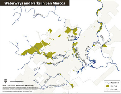
San Marcos’ natural areas serve several important functions, including water quality protection, recreation, and as we experienced at the end of October, floodplain buffers. Many of San Marcos’ creeks are intermittent or dry most of the time, and it is easy to forget their importance. But for the SMGA greenway vision, these creeks are the backbone of this interconnected system of parks and natural areas.
 |
| Map courtesy San Marcos GIS Dept. Steele and DeAnda |
According to the San Marcos Daily Record, City Manager Jared Miller, said “San Marcos received eight to 12 inches of rain during that 90 minutes” Friday morning October 30, 2015. The rain fell over a wide area and flowed out of the banks of the San Marcos and Blanco Rivers. This time Purgatory Creek with its many tributaries flowed to the San Marcos River, and Sink Creek did the same by way of Spring Lake. The two largest natural areas, Purgatory Creek Natural Area and Spring Lake Natural Area, both experienced powerful water flows. While these natural areas received damage and need time to recover, we are once again thankful for our San Marcos natural areas. –MH

