By: Christian Hawley
March 1, 2026: On the Trail of Hudson Stuck
Growing up, I played a game that eventually became a show called “Where in the World is Carmen San Diego,” whose apparent intent was to teach kids world geography, but whose unintended consequences created a small generation of trail hounds who love a cappella music.
Carmen San Diego started me on a lifelong pursuit of gypsy souls, from Davy Crockett to Anthony Bourdain. Following these intrepid people also delivered me to some of the best trails of my life. I remember reading John Muir’s “My Summer in the Sierras,” and then decades later having a pang of longing fulfilled as I came out of the Wawona Tunnel and saw Yosemite Valley for the first time. The John Muir Trail did not disappoint.
I read Edward Abbey’s “Desert Solitaire” while I chaplain in Idaho; a book that changed the course of my life, as I chose to go to school in Texas, not Virginia, since Arches National Park was on the way from Boise to Austin.
 A poem about Haddie Stillwell took me to Big Bend National Park. “The Land of Little Rain” by Mary Austin fanned a tiny ember of love for desert landscapes, and “Eating Stone” by Ellen Meloy continues to bring me back to Bluff, Utah, year after year. The Carmen San Diego effect has been a blessing in my life.
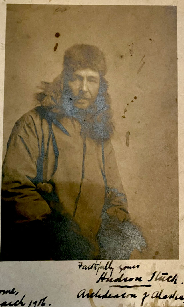
Most recently, I’ve been on the trail of Hudson Stuck. An Englishman who flipped a coin in 1885 — heads, Australia; tails, Texas. Tails it was, so Stuck and a close friend caught a freighter to New Orleans and then on to Junction City, TX, where they worked as ranch hands. The romantic life delivered adventure, but not much in the way of livelihood, so the educated Stuck became a teacher in San Angelo, Copperas Cove, and eventually here in San Marcos in 1888.
I picked up his trail here and over the last year followed him to Sewanee University, where his papers are kept, and he trained as a priest in the Episcopal Church. Next, he went to Cuero, then Dallas, before his final frontier of Alaska. There, he logged over 10,000 miles on a dogsled as the Archdeacon of the Yukon.
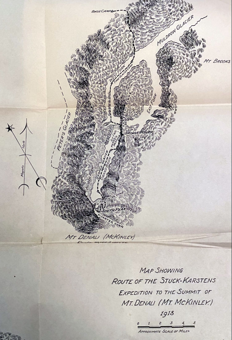
Alaska was where Stuck’s trail took an unconventional turn, because chances are you’ve never heard of him in the same way you’ve heard about Edmund Hillary (first to the top of Mt Everest), or Alex Honnold (first to solo El Capitan), yet Stuck led the first successful expedition to summit Denali, the tallest mountain in North America.
Unlike some of those other names, Stuck took a back seat to his indigenous partners. He brought along Walter Harper, of the Koyukon people, who went on to be the first member of the party to summit the mountain, and to this day is commemorated in Alaska on Jun 7th—Walter Harper Day.
I hope to follow Stuck to Alaska one day, and maybe even to the summit of Denali (remarkably, Stuck was 50 when he achieved this feat), but in the meantime, I’ll track him through the pages of “A Window to Heaven,” his recent biography by Patrick Dean, and imagine walking beside him on the trails of the Spring Lake Natural Area, surely an activity of his as he whiled away his weekends here in San Marcos.
March 8, 2026: Stop and Smell the Agarita
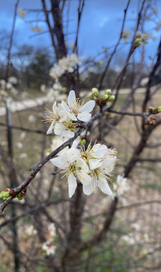
A Mexican plum tree stopped me in my tracks on the last Wednesday of February. I had been minding my own business, walking down the Dante Trail from the lower Purgatory Creek Trailhead, when a sweet perfume assaulted me. The fragrance snapped my head back, and as I followed my nostrils around, I beheld tiny white flowers unabashedly dancing in the wind.
Horror quickly replaced delight as I contemplated this springtime occurrence. Surely this plum was misguided. Surely this wasn’t the end of winter. Surely this wasn’t a harbinger of what is coming to feel like perpetual summer. But alas, friends, it was. Spring has sprung, and my wife has already put our tomatoes in the ground (unfathomable to a guy who grew up with a frost date of May 13).
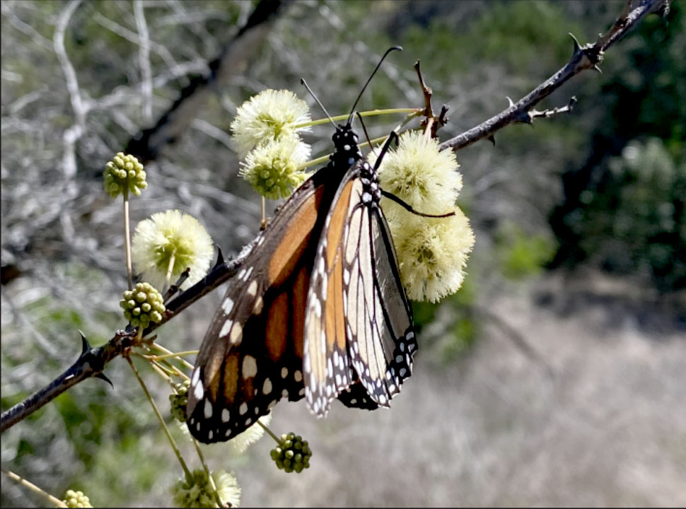
Yet I cannot lament for long because my favorite fragrance is upon us. I love agarita season. For most of the year, these poky little shrubs serve mainly to keep me from straying too far from the trail; however, for a few weeks, early every spring, they turn the Swallet Trail at the River Recharge Natural Area into a tunnel of olfactory delight.
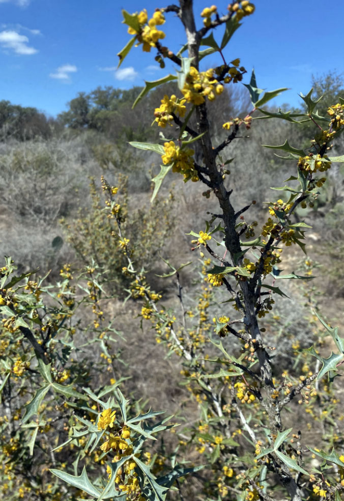 Known as Texas Holly or Chapparal Berry, these plants abound on our local trails, and right this moment they are aflame with tiny yellow flowers in clusters of three. I’ve only ever enjoyed the smell, but herb lore says the roots are used to treat stomach aches and to dress wounds. I also hear the berries burst with a sweet-tart flavor that many Texans use in jams or even pies. Speaking of edible nature, it is also Redbud season.
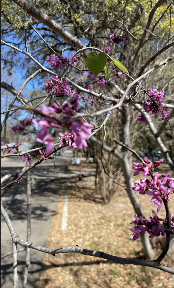 My daughter loves to shock city folk by running up to Redbud trees planted in urban areas and devouring the delicate pink petals as if they were candies off a cake. Redbuds are part of the pea family, and many of their parts are indeed edible. Our family likes to gobble up the flowers fresh off the branches. I’ve always thought they had a citrusy tartness to them, and it turns out that they are high in vitamin C. I have also heard tell that the buds can be pickled as a substitute for capers, which has given me a great idea for a different kind of pasta primavera.
So whether you love the grape Kool- Aid smell of Mountain Laurel, the honey-sweet aroma of agarita, or the sweet-tart taste of Redbud, you’ll find a delight to your senses on the trails of San Marcos. Get out there while you can, San Martians…summer is coming.
March 15, 2026: Bikes Across Borders
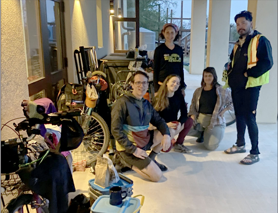 “Cat litter buckets are the best-kept secrets in cycling,” Paul tells me as we drink coffee on the back porch of St Mark’s Episcopal Church, where he’s just spent the night sheltering from Saturday night’s storms.
Megan echoes, “They are water-tight, and fit perfectly as panniers on almost any kind of bike.”
“Panniers?” I ask. “The storage containers mounted on the sides of bikes. Mostly used for bikepacking in our country, but also for daily commuter needs around the world. Which makes them perfect for our mission,” Tawny explains.
Paul, Megan, and Tawny are part of a non-profit called Bikes Across Borders (bikexborders.org) that has been riding from Austin to Mexico for the last 26 years. Their mission is simple and beautiful: “to build solidarity partnerships by promoting autonomous transportation & cultural arts.”
Most participants on the US side spend the year fixing up and kitting out bikes. A partnership with the Yellowbike Project provides participants with the space and know-how to build and maintain bikes to not only survive the journey to Mexico, but also to deliver transportation that the recipients can count on and maintain themselves. The resulting Rocinantes tend to be sturdy steel frames with simple, off-the-shelf brakes and derailers and come with their own lights, locks, and repair kits. 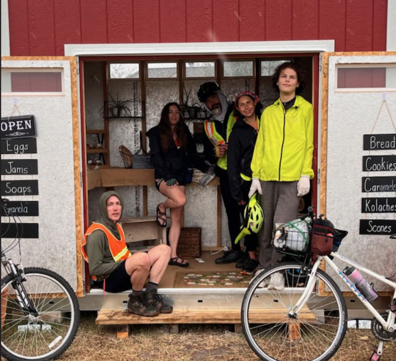
“So what are you doing in San Marcos?” I query.
“We’ve fallen into the rhythm of riding to Monterrey or Piedras Negras on alternating years. This is a Monterey year, and so we ride down to San Marcos before jumping on 123 toward Seguin. In the early years, we were part non-profit ride and part performing arts tour,” Paul explains.
“Performing arts?” Tawny laughs, “Yes, puppet shows and variety theater in every town we stopped in.”
I look curiously at the cat litter panniers. “But not anymore. Now we mostly support the arts along with autonomous transportation. This year, we’re partnering with an artistic indigenous population in Monterey, so we’re not only delivering bikes, but also musical instruments.
Again, I look to the kitty litter storage containers as if they were Tardises from Dr. Who (bigger on the inside).
Anthony jumps in, “We have a box truck that will be joining us tomorrow, and they’re hauling all the instruments and our portable kitchen.”
“Cool,” I say, “so what exactly is your route?”
“Uhh. Austin, San Marcos, and Seguin,” Tawny starts.
“Then there’s a stop in Beeville, too,” Anthony throws in. “Ohh, and we’re crossing over in Reynosa this year,” Isabell adds.
“And then some places in Mexico,” Paul finishes.
I grin at their sense of adventure.
Megan finishes, “This is partly a mission of solidarity, but it’s also a testament to possibility. People think you need $3,000 bikes and four-person support teams to ride long distances, so we also want to show you can get out there on a $100 bike with your friends and see the country in a brand new way.”
“Amen.” I say, and then, “happy trails from San Marcos.”
March 22, 2026: Government Canyon Getaway
Government Canyon offers a delightful combination of contradictions. It’s an urban wilderness where the Far Reaches Trail cruises past sotol-studded vistas and urban-sprawl subdivisions.
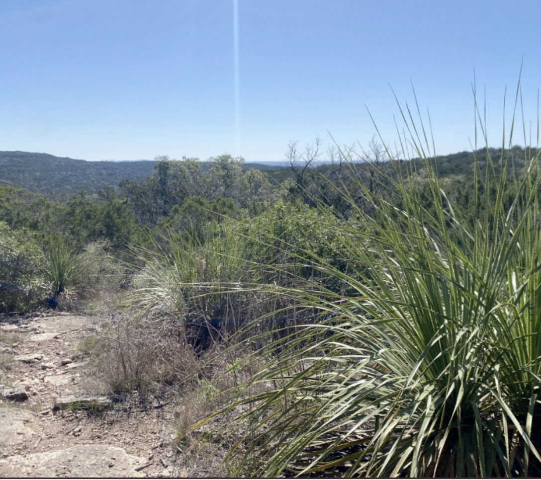 It’s a state natural area whose facilities are way nicer than most state parks, and it provides true silence in the backcountry punctuated by the occasional C-5 Globemaster military aircraft coming in for a landing.
At only an hour and a half away, Government Canyon offers a great weekend getaway with all of your closest San Antonio friends. I booked a night at the walk-in tent campground, and the parking lot consisted of a who’s who of outdoor enthusiasts: minivans with bike racks, sprinter vans with birding bumper stickers, dirtbag Civics with backseat blinds, and enough Subarus to qualify as an outdoor festival. Whatever your fancy, Government Canyon has something to offer.
For young families: The Frontcountry Trails allow easy walking or beginner biking for little legs, while the Joe Johnston Route provides easy access to the backcountry as children age into adolescence. Throw in some legit dinosaur tracks on a five-mile hike, and you’ve got a great family weekend. The tent campgrounds are spacious and accommodating with their own cedar varmit boxes, but bring a wagon to haul your stuff.
For high adventurers: With over 40 miles of trails, Government Canyon provides challenging climbs, exhilarating descents and enough room to really stretch your legs. The Far Reaches and Sendero Balcones Trails climb high into the sotol-covered peaks via rugged limestone trails where 29-inch tires or max-cushioned trail shoes can be put to the test. Your rise-and-grind attitude pays off as you can bomb down the Wildcat Canyon Trail or flow with the forest single track by connecting to the Twin Oaks Trail. Throw in Caroline’s Loop and the Joe Johnston Route, and an epic 12-mile excursion awaits.
 For hikers, birders, herpers, and naturalists: The best time of year is Sep-Feb when the Protected Habitat Area is open and restricted to hiking only. However, if you go now, you can still catch the Mountain Laurel in bloom, and all sorts of creatures beginning to stretch their wings. Butterflies, birds, lizards, and even salamanders greeted me on my journey, and with a
 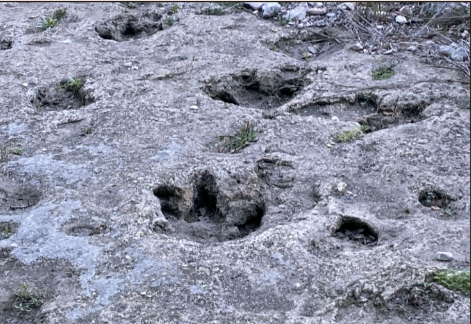 few hiking-only trails like Bluff Spurs and the Overlook Trail, you can enjoy the views without the worry of a bike or a runner coming out of nowhere. With Frontcountry, that’s mostly savannah and a backcountry that’s mostly highlands, the chances for diverse wildlife encounters abound.
March 29, 2026: Horizons of Texas Hiking
I moved back to Texas from Knoxville, TN, in the summer of 2014, and the following spring of 2015 was one of the snakiest years I can remember in Texas. I’d come across Eastern Diamondbacks before on the blue blazes of the Appalachian Trail, but only once or twice and never on the main trail, so my hiking habits did not include a regular downward scan for snakes.
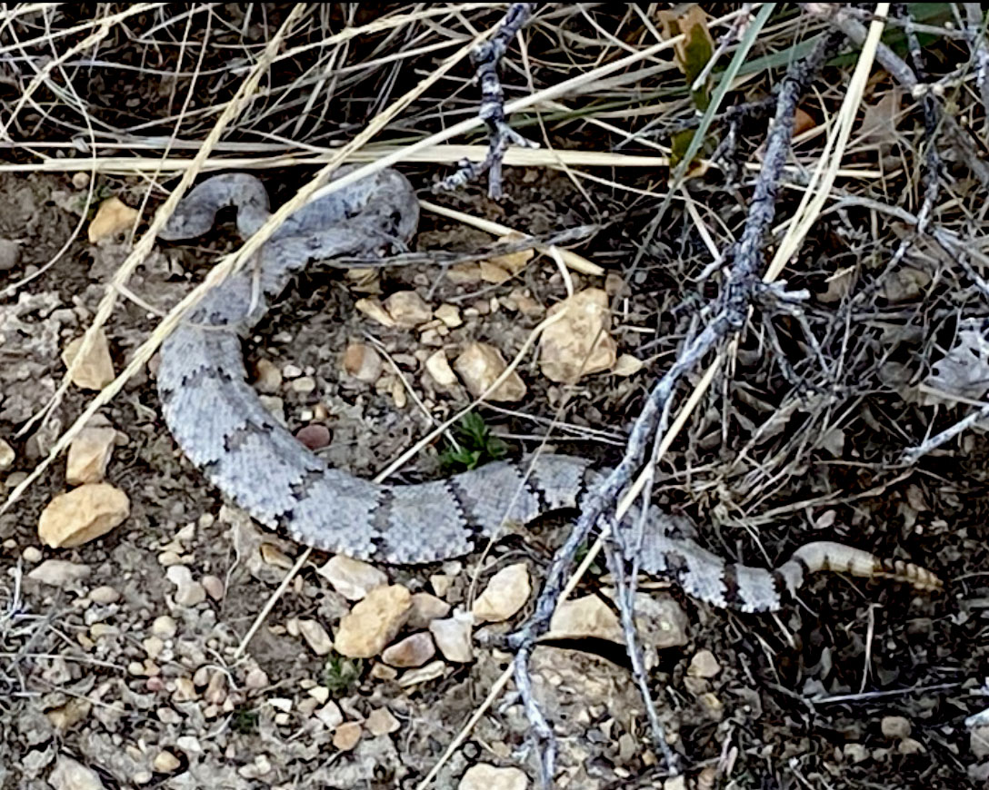 Yet in the spring of ’15, I almost stepped on a Western Diamondback rattlesnake at McKinney Falls State Park, Caprock Canyon State Park, Palo Duro Canyon State Park, Big Bend National Park, and even our own little pocket park of St Edwards in North Austin. Walking away bite-free was only by the grace of God, and I vowed after that spring to always add a regular downward glance to my hiking routine. Hence, the first and nearest horizon of hiking in Texas is 5’ ahead and 1’ on each side of the trail.
Texas also changed my heads-up horizon for route finding. Again, I was coming from the East Coast and Southeast, where trails were marked by blazes, colored rectangles painted on trees or rocks at eye level. Many trails in Texas use a blaze or placard system (SMGA’s round colored medallions are especially nice), but many trails do not, particularly in West Texas parks.
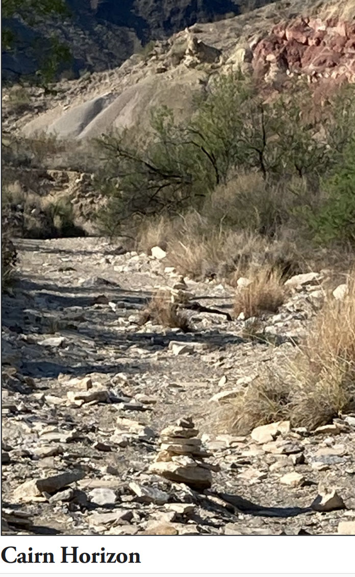
I remember being completely disoriented on the Dodson Trail of Big Bend because I could never find the next trail marker. Only after careful study and the shadow of a memory about cairns did I realize my eyes needed to be scanning for stacks of rocks, not swatches of paint.
 Cairns usually appear at trail level, but on ascents and descents, they are often stacked on top of existing boulders, so the horizon can range as large as 45 degrees up or down from horizontal, depending on the terrain. A whole new neural mapping shift is required to follow cairns, and it took me almost three years to make it my new default. So, in addition to the snake horizon, the cairn horizon requires more than just looking straight ahead.
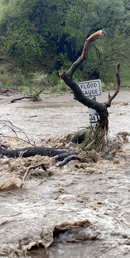
The last horizon deals with storms, which are not terribly hard to notice if they form in the direction of your travel, but too often they form behind you, and come sweeping down upon you right before you’re about to summit the highest point in the park. I thought I had learned this lesson on the Barr Trail up Pike’s Peak in Colorado, but I needed a reminder at Davis Mountains State Park last spring. I clocked some fluffy white clouds building beyond McDonald Observatory on my way up the Limpia Creek Trail, but I lost them as I turned onto the Sheep Pen Canyon Loop Trail.
 When I reached the Limpia Creek Vista and turned around, those fluffy white cumulus clouds had transformed into a menacing, dark thunderhead, which put me to flight back down the trails and eventually drenched me miles from my vehicle. The final horizon is the sky, and not just the sky up ahead of you, but the sky all around you. Have fun hiking in Texas this spring, and don’t forget to check your six.
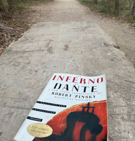
April 12, 2026: The Inferno Comes to Purgatory Creek
March 25th marked the day Dante “midway upon the journey of his life found himself within a forest dark, for the straightforward pathway had been lost,” thus kicking off “The Divine Comedy.” So it seemed right to meet and sit down on that day with Virgils of the San Marcos Greenbelt Alliance, Todd Derkacz and Cameron Herber, to find out about the new trails in Purgatory Creek: Inferno and Farinata.
 Before we even broached names, I learned about the art, the science, and the social alchemy of naming trails. The art comes in choosing names that resonate through all kinds of communication media. Names need to be unique and pronounceable, so if you are a visiting New Englander telling a friend or a first responder where you are located, you don’t have to guess at the pronunciation of Menchaca.
Likewise, the science requires choosing names with first letters that don’t already exist in the park system, so that the trail markers don’t become too cumbersome. Science also dictates that appellations must mesh with the theme. So while Manfred, King of Sicily, is totally on brand, because Malacoda already exists at Purgatory Creek, Manfred doesn’t make the cut.
Finally, the social alchemy comes from balancing popular practice with stakeholder preferences. As it turns out, this balancing act also applies to the trail blazing and maintenance of official and rogue trails. Todd explained rogue trails, aka social trails or desire paths, come about when the general public blazes its own way independent of official entities like SMGA or SM Parks and Rec. Rogue trails offer great insights into our community values, from shorter connections to less-technical terrain, even though they may frustrate stakeholders’ designs and preferences (trail maintainers worldwide have unpublishable names for rogue trails).
 Cameron told me both Inferno and Farinata started life as rogue trails and that SMGA learned how to adapt them to the larger plan, as well as adjusting their own plans to provide more accessible foot travel for a user group that was growing rapidly in numbers, abilities, and distances traveled. Purgatory Creek is now a destination trail system, and the names of these new trails reflect that reality.
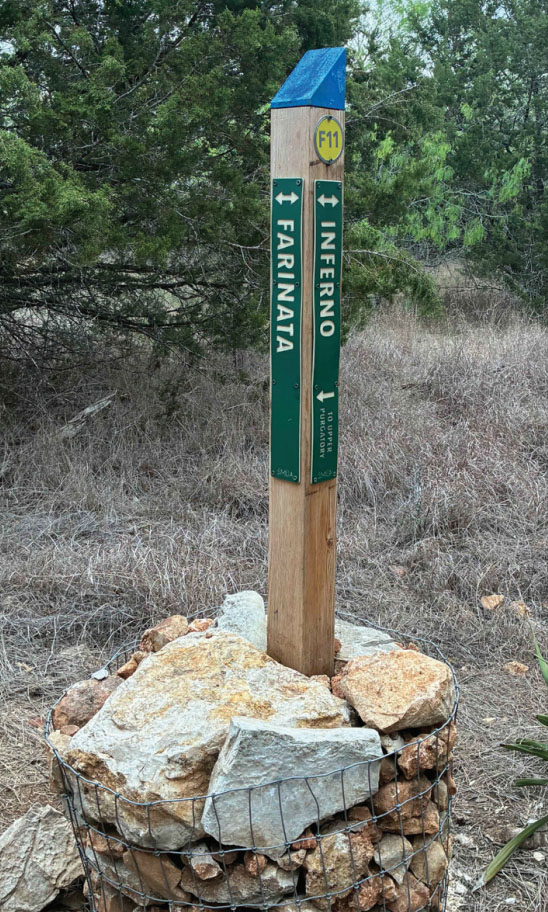
Inferno is unique and pronounceable, starts with I, which isn’t represented in the trail system, and captures the Dante theme wonderfully for an exposed footpath. Inferno is also a clever adaptation of the crowdsourced name “Ring of Fire,” found on both Strava and Trail Forks.
Farinata checked the art and science boxes as well but took a little more alchemy. Cameron revealed that volunteers and city employees lobbied hard for a number of different names, but eventually Farinata rose to the top, given his unique role in the Divine Comedy.
Farinata was the Florentine politician who resided in the sixth circle of hell reserved for heretics. Dante respected Farinata even though he disagreed with him vehemently, thus casting him as a kind of noble damned character in the Inferno. It’s exactly the kind of name trail maintainers would give to an adapted rogue trail.
Given all the hard work that’s gone into converting these trials and the clever alchemy in naming them, it would be a shame if we didn’t use them. So San Martians, get out there and enjoy these destination trails in our own backyard.