Staying oriented when on a network of trails relies on having a plan, access to good information on the trail network, and making decisions whenever you reach a trail intersection.
Anyone can avoid getting lost if they know these four key things and have access to good map resources: Where am I now, what trail am I starting on, what other trails compose my complete route, and how will I know I have reached my destination?
Assuming you have smartphone access to online information throughout the hike, these four questions can be resolved at any point in the outing. You can consult an online interactive map using your smartphone and the QR code found on the large kiosk maps.
 Some GPS apps for iOS and Android allow the download of maps for offline use while still connected to the internet. When the download is complete, navigation in airplane mode is a viable option for saving battery life. The GPS receiver in your smartphone still functions in the absence of a cellular signal.
A good plan, if you have no technology available, requires you know the four key things before beginning. It also depends on your having acquired a map you can refer to as needed.
Fortunately, the City of San Marcos and the San Marcos Greenbelt Alliance have worked in synergy to provide good information resources. Maps are on display at trailhead kiosks and online at both the City and SMGA websites. The City maintains an interactive map online that allows you to use your smartphone GPS technology to actually see where you are located at any time. In addition, there are PDF maps in two sizes that can be downloaded or printed if you prefer an offline resource.
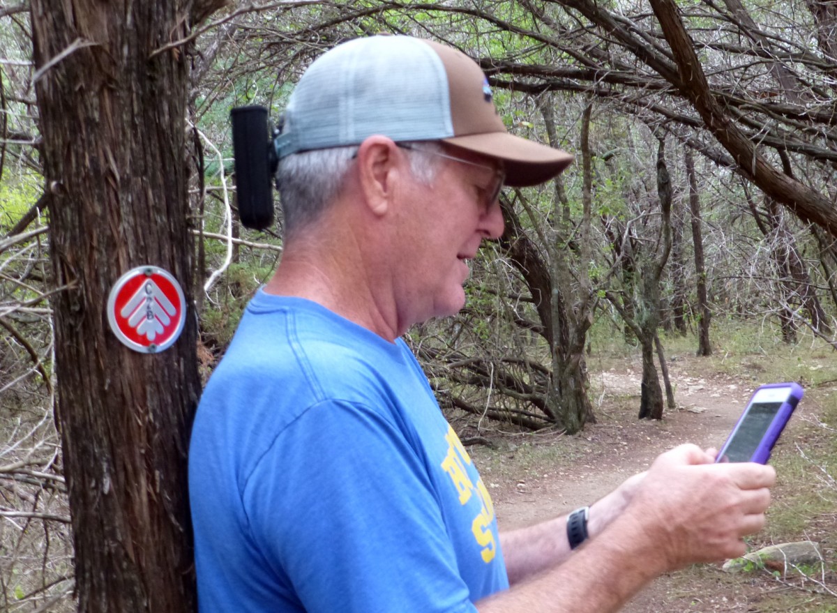 While on the trails you will see both signposts bearing trail directions as well as two-inch diameter metal trail markers roughly every 200 feet along the trails. The signposts are placed and maintained by SMGA and are intended to provide assistance at points on the trail where a decision may be required, such as a trail junction. The trail markers are placed by City personnel that are involved in first response events. Each marker is unique and dispatch personnel can immediately know where a caller is located if given the information on the marker. It is also very useful for navigation to learn to read these markers. Study the legend on the large map at the kiosk and you will find the key to these markers. Each trail name corresponds to a trail marker icon and color combination. Each marker also contains embossed letters for the trail name and sequential numbers for the entire length of the trail. This may seem confusing at first, but once you gain comfort with the markers, they are very helpful for navigation.
Hike and bike safely and be courteous to other users. They can also be a good information resource.
Written by Joel Barks, member of the SMGA board and trail crew.