 |
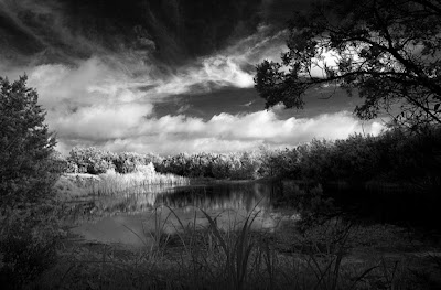
| Peaceful Pond by Herb Smith (taken at Spring Lake Preserve) |
SMGA has had many meetings, discussions, and phone calls with elected officials and staff regarding the proposed wastewater line through Spring Lake Preserve. Thank you to everyone who has shared concerns with elected officials. We are pleased that city officials are stepping back and reviewing the alternatives (http://www.sanmarcosrecord.
The issue of the Sink Creek Wastewater Interceptor line is complex. In some ways it is very simply about preserving the Spring Lake Natural Area as we, the citizens of San Marcos, wanted and promised to do. We voted for a bond to help fund conservation of the 251-acre area, and agencies worked together to raise a total of $4 million for the project. Through a TPWD grant, an ADA accessible trail was recently completed, and educational kiosks, benches, a sundial, and a boardwalk were added to increase accessibility and educate visitors about the sensitivity and importance of Spring Lake Preserve.
We promised that the land would be conserved, and we should insist that it is. But there’s more to the issue than park boundaries – clearly defined lines on a map – and this is where the issue becomes less black and white and much more gray.
If a sewer line goes through Spring Lake Preserve, then what if it leaks? A slow leak could contaminate the water that fills Spring Lake and Aquarena Springs. What about bird habitat? A 12-foot wide, crushed limestone maintenance road would be required over almost all 2100 linear feet of the wastewater line through the preserve. Trees would have to be cut down and vegetation cleared. Unfortunately this vehicle path would not have the sway and flow of a good trail design, and clearing more vegetation would continue to reduce the habitat of the Golden-cheeked Warbler, the endangered species that the area is funded to protect.
What if the sewer line is installed outside the boundaries of the preserve, which would not require TPWD approval, but still within sensitive animal habitat? Property boundaries are lines on maps that are black and white and well defined. However, if you walk around the preserve, everything is much less black and white and much more gray. Water, habitat, birds, and trees do not observe the black line on the map – the preserve boundaries. It’s all interconnected for them, and really is for us as well.
Wastewater lines are old and overflowing and need to be replaced and expanded. This is not an issue that the people of San Marcos can or should ignore. Faulty wastewater infrastructure is a detriment to our water quality. What’s an alternative route for the sewer line? Where do we, as SMGA, draw the line as to what is and is not an acceptable path for the sewer line?
It’s difficult to draw that line in an interconnected world. What we can do is connect the SMGA vision with others’ visions by building partnerships and looking at new ways of expanding the vision and the greenway. Our greenway line is going to cross with many, many other visions and city needs. We must work with, not against, cities, counties, TPWD, USFWS, land trusts, and individuals. We have communicated our concerns with officials and agencies and are pleased at the level of discussion and openness between all the parties. We will continue to strengthen these partnerships and work on this issue. In the meantime, please continue to share your opinion with city officials by emailing them at [email protected]
– Maggie Hutchins-Wagner, SMGA President
