[Reprinted from the August 2019 LOOP with updates.]
Regular visitor or first-time trail user — all need to know where they are
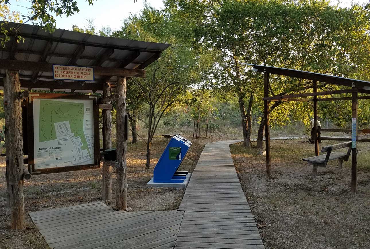
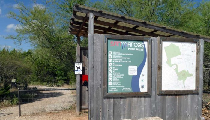
The City of San Marcos GIS Department maps the 22 miles of designated trails in more than 1,200 acres of natural areas. The Greenbelt Alliance and Parks & Recreation Department coordinate and assist with this biannual project. New display maps (48” x 40”) should be posted at the eleven trailheads in five of the natural areas to reflect changes in Purgatory Creek and Spring Lake natural areas.
The city, with help from Texas Parks & Wildlife, added an ADA trail (American with Disabilities Act) called Styx to Upper Purgatory. It’s a beautiful, wide trail that brings out the families and wheelchair-bound to get out in nature. This necessitated SMGA to make some changes to Dante for the single-track experience. It also makes for a nice loop trail for those wanting a little more nature.
Grey Fox in Spring Lake was re-worked to reduce the erosion that the previous landowner’s jeep track was causing in the downhill portions. Mountain bike riders enjoy the challenge Spring Lake offers with its numerous up and down hill runs at Blind Salamander, Grey Fox, Roadrunner, Porcupine and other trails offer to the intermediate and experienced riders.
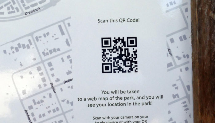
Paper maps will also be available for downloading to electronic devices and printing (8.5 x 11”) at both the SMGA and City of San Marcos websites. These maps will note the mileage of each section of trail for planning your next outing.
The display maps (40 x 48”) posted at the trailheads are unique and can aid first responders in locating hikers/mountain bikers. To use the service, scan the QR (quick response) logo on the map with your smart phone. Once the real-time map has loaded on to the device, touch the circle logo on the left. Viola! – your position appears as a blue dot. As you travel on (and off) trail your location is mapped.
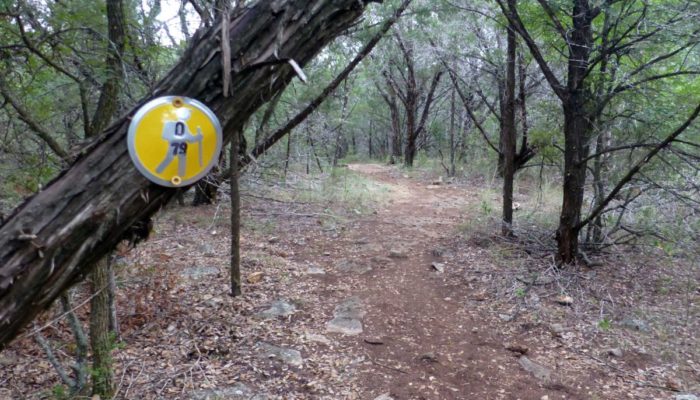
Round trail markers with the code for the trail name and a number also place you in the natural area, on a specific trail enabling 911 operators to dispatch emergency assistance to your location. Other smart apps like AllTrails, Strava, and TrailForks also provide a Latitude/Longitude position that can be passed to the operator. Cell phone reception within the 1,200 acres has improved and most areas have coverage by all the providers. Using the continuous GPS location feature will drain your battery faster, so keep that in mind. The best advice is to learn these systems before it becomes necessary to use them. By all means, get outside and enjoy what the natural areas provide — fresh air, stress relief, sensory stimulation, a new learning environment and much more.
Written by Lance Jones, a Hays County Master Naturalist as well as a long-time SMGA volunteer and former board member.